'We make boating fun'
t:01489 588977
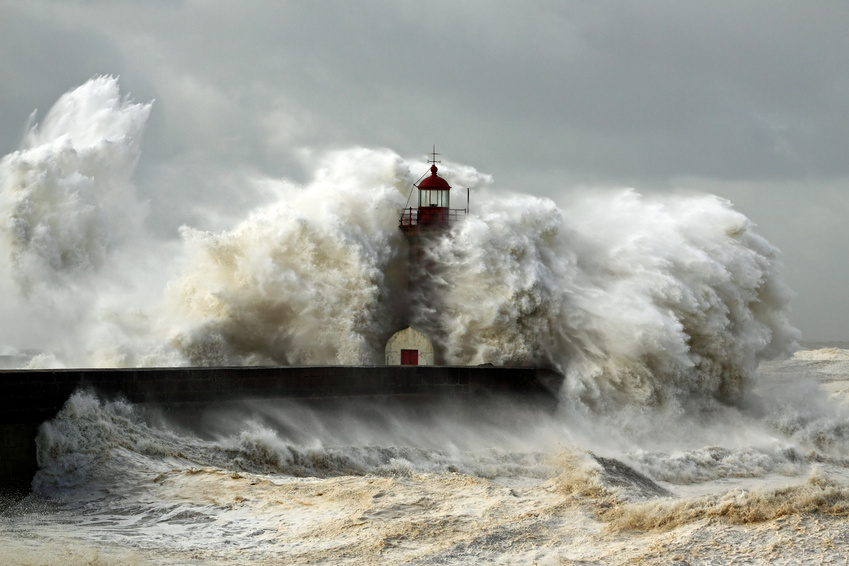 Well what a month it has been, severe storms seem to have been happening almost from the moment I finished my last article. Anybody with a boat or a vague interest in the sea will have been concerned with the impact of the weather, and as for the poor souls inland, well we all know that the Somerset levels are meant to flood – they have for hundreds of years, but the impact of nearly a years rain in a month and the wettest on record has been devastating.
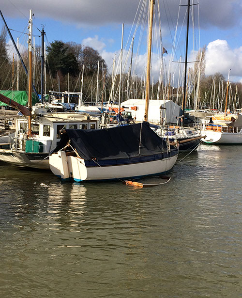
But what does it mean for seafarers? Well firstly if your boat is ashore, then please do visit and make sure that the covers are all sound and nothing has come loose, high winds quickly turn something flapping into something broken. If the covers get a pool of water on them they will stretch and never fit correctly again. If you have been afloat, even in a marina then water also weighs a lot so this in itself could cause stability problems and double check your mooring lines, rotate them so that the load and strain is on different parts of the boat and different cleats. Additionally lines chafe so inspect them really carefully as a parted line could spell disaster. Extra lines are also a good bet, in case one parts a second will take the strain.
If you survived the marina and are getting ready to venture out – we have had a couple of sunny days, but there are extra issues to be aware of, firstly the storms and very high tides have released a huge amount of debris into the rivers and hence out to sea, so far I have seen huge lumps of tree, two sofas, and several oil drums, so extra caution is required. The water has also dramatically changed colour, from our normal Solent brown / green depending on the sunshine available to a rich dark chocolate brown!
 The dramatic images that we have seen all over the television news also have a serious impact that we tend to forget after the news has moved onto something new, where did all that water go? In central Southampton the River Itchen has had the huge floods coming down from the farm land around Winchester and exiting out into the river at Woodmill, scouring a whole new channel and altering the flow of the river and there is visible shallowing on the inside of the bends in its lower stretches. Here on the River Hamble, the incoming wind generated a huge surge on Valentine’s night washing into the Boathouse Café in Swanwick Marina, and several cars were towed out the following morning after water up to their windows.
But what about at sea? I am thinking about the huge waves landing on our shores and the furious currents that were washing around our area, Calshot Spit Light Ship turned over on one night of the storms and was replaced with a pair of temporary yellow buoys marking its position only now two to three weeks later has it been fixed and is now back on station. Down at New Milton about a 100 beach huts are now missing and most of them were concrete, so where has all that debris gone and what has happened to all those nice charts with depths on that we rely on for our information and safety.
Well common sense tells us that anywhere with a soft sea bed, such as gravel, sand or mud is going to be effected much quicker, rock does not change much, add in where a channel is fairly narrow or passes through a cluttered area like the Thames Estuary, so as you close the shore or approaching a harbour extra caution needs to be exercised, with a close eye kept on the depth. Around the Solent the Needles Channel shingle bank has undoubtedly moved a bit and the second bank that is just West of the East Cardinal and South of North Head probably needs a slightly more cautious approach!
But how and where do we find out the latest information? Well all the harbour authorities rely on reports from mariners about any change which is significant, they will then investigate to see the extent of the problem, this is then reported in local Notice to Mariners. Its good practice to consult them on a regular basis, both the Port of Southampton and Portsmouth, have regular updates. Additionally all the chart manufacturers from Imray to the Admiralty have chart corrections going out on a weekly basis, this has all become much easier with the internet as all you have to do now is enter the chart number and the page of corrections comes up, you can then read them to see which are most relevant to you, and if sensible make the necessary alterations to your charts.
Imray Corrections: Click here
Admiralty Corrections: Click here
The days of electronic chart plotters have made the navigation game much easier but potentially more dangerous, physically reading through a list of corrections and comparing it to your charts, noting anything that is likely to effect you is far more powerful and you remember it much better, than turning on an electronic plotter and not even considering what’s changed. Additionally not many people actually update the electronic charts or even know how to, so best bet is get the manual out and find out how, a yearly update would be ideal, but those that bother tend to do it bi annually. One of the big issues with the electronic charts is that they tend to release an update yearly, so you can go for a whole year with incorrect charts and the latest release is often a few months old by the time its released, so be careful!
So in summary, after any storm take care, depths might not be what you expect, watch the water more closely than normal and just be a bit cautious with the speed.